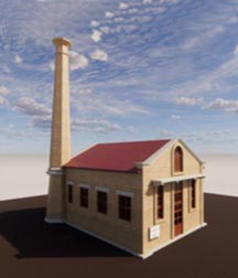
This pilot project involved 3D modeling of a heritage building at NED University of Engineering Technology, Karachi, using photogrammetry through a drone survey. Images of the building were captured from all perspectives, rendered, and stitched together using computer programs to create a virtual walk-through. A point-cloud was processed from the survey data, allowing for detailed spatial planning.